
Vancouver ZIP Directory Areas
City planning material uses ten ZIP geographies to describe Vancouver and nearby areas. They are useful labels for a ZIP code directory, but they are not a postal boundary ruling. The 2024 engagement summary and 2021 tree-canopy assessment are dated City studies. USPS delivery groups, incorporated limits, neighborhood associations, and Census ZIP Code Tabulation Areas may differ.
| ZIP Code | Areas Covered | Post Office | Notes |
|---|---|---|---|
| 98660 | Fruit Valley | Grouped with Vancouver 98661 in USPS L012 | Confirm each delivery address |
| 98661 | Harney Heights / Meadow Homes | Vancouver 98661 | Postal and city lines differ |
| 98662 | Five Corners / Orchards | Grouped with Vancouver 98682 | Check GIS and USPS |
| 98663 | Rose Village | Grouped with Vancouver 98661 | Area label does not identify an occupant |
| 98664 | Ogden / Vancouver Heights | Grouped with Vancouver 98683 | Run a city-limit check |
| 98665 | Hazel Dell | Vancouver 98665 group | Postal city extends beyond city |
| 98682 | North Image / Mill Plain / South Orchards | Vancouver 98682 | Neighborhood labels are approximate |
| 98683 | Fisher's Landing | Vancouver 98683 | City study has aggregate statistics |
| 98684 | Fircrest / Evergreen | Grouped with Vancouver 98683 | Verify address and jurisdiction |
| 98607 | Toward Camas | Overlaps Camas geography | Clear planning and postal mismatch |
USPS L012 also groups 98666 and 98668 with Vancouver delivery labels, and groups 98685 through 98687 with Vancouver 98665. Those supplemental codes are not part of the City's ten-area survey set. The research did not confirm whether 98666 or 98668 currently functions as a PO-box-only or unique code, so this Vancouver ZIP code directory does not assign either label.
Neighborhood names in the table are approximate labels from City material. Fruit Valley, Rose Village, Meadow Homes, Fisher's Landing, North Image, and Fircrest or Evergreen each have their own local context, yet none defines a postal code by itself. A single code can contain more than one neighborhood, and one neighborhood concept may cross another agency's line. For a specific home, replace the broad label with the verified street address and parcel before searching any record.
Why Vancouver Counts Ten ZIPs
The ten-code list belongs to a City survey universe, not a claim that Vancouver has only ten possible postal labels. Its inclusion of 98607 “toward Camas” makes the distinction easy to see. A planning team may group responses by a broad geographic label, while USPS assigns delivery based on its own routes and facilities. A county map may then show a parcel inside or outside incorporated Vancouver.
That quirk affects resident research. Searching only the ten City study labels can miss a supplemental Vancouver mailing group. Treating every Vancouver mailing label as city jurisdiction can send a request to the wrong office. Keep the source and date with each boundary statement, and verify the actual address through USPS, the City checker, and Clark County parcel data.
Verify Vancouver ZIP Code Fields
The USPS ZIP Code Lookup offers three distinct tasks. Choose the task that matches the known facts. A returned code confirms postal addressing, not that a named person or group receives mail there.
| Lookup mode | Required fields | Optional fields | Useful result |
|---|---|---|---|
| By Address | Street address, city, state | Company, apartment or suite, ZIP | Standard code for a complete address |
| By City and State | City, state | None documented | ZIPs associated with the postal city |
| Cities by ZIP | ZIP | None documented | City names associated with the code |
USPS screenshot capture failed in the supplied manifest, so no image is shown. The field table comes from the inspected portal inventory. Recheck the live form if a control changes.
Map Vancouver ZIP Code Geography
Clark County MapsOnline includes a Zipcode layer along with parcels, roads, addresses, subdivisions, annexations, building footprints, permits, and district information. Turn on the ZIP layer, browse to the area, and use parcel identification to interpret what lies near a boundary. The layer is visual geography. It does not generate a complete list of people.
The separate GIS Addressing service includes address points, duplicate-address flags, hundred-block groups, taxlots, directional quadrants, and the Clark County/Vancouver address grid. That combination helps when an address has a directional form or lies close to a code edge. Search and export controls were not exposed on the static Addressing landing view, so do not promise a ZIP-wide download.
The manifest's GIS Addressing capture shows the official layer source used for this step.
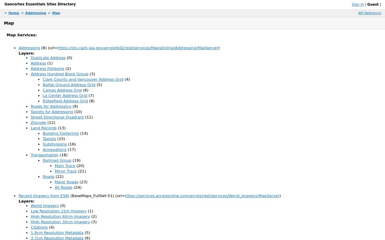
The available layers help reconcile a code, road, parcel, and jurisdiction without turning ZIP geography into a resident roster.
Narrow Vancouver Residents by ZIP
A ZIP code directory provides a starting area, not a public people list. Clark County PIC documents searches by street address, tax account, and limited owner name, but no public ZIP-wide owner search. MapsOnline can display ZIP geography while parcels are browsed. VoteWA requires the voter's own first name, last name, date of birth, and reCAPTCHA, so it is not open resident browsing.
- Verify the complete address in USPS ZIP Lookup. Save the standardized street, city, state, and ZIP form.
- Check whether the address is inside Vancouver with the City address checker.
- Use MapsOnline's ZIP layer to see the parcel and nearby code geography. Confirm the parcel or tax account.
- Open PIC for the address-linked public parcel facts. Allow for ownership and mailing updates that can lag a recorded document.
- When a specific public record is still needed, ask the right city or county office by subject, date, address, and record type.
Once the code has narrowed the area, the Vancouver street directory explains the address-level trail. Never treat a parcel owner, tax mailing recipient, voter, or directory entry as automatic proof of present occupancy.
Request Vancouver Records by ZIP
A records request may be useful when no public portal offers the needed ZIP filter. The City accepts online, mail, fax, in-person, verbal, and email requests. Clark County uses GovQA, mail, or the office that holds the record. Under Washington's Public Records Act, the agency responds within five business days by producing records, giving an estimate, seeking clarification, or denying under a stated exemption. That response window is not a promise that all records arrive in five days.
Describe the record rather than asking for an undefined list of people. Include the office, topic, date range, ZIP or mapped area, and preferred inspection or copy route. Agencies still apply exemptions and redactions, and a ZIP may cross jurisdictions. City requests can start at the Vancouver public-records page; county requests start at the Clark County records overview.
Note: A clear date range and record category usually works better than a request framed only by a postal code.
Historic Vancouver ZIP Address Clues
ZIP codes are modern postal tools, while older Vancouver sources may describe an intersection, subdivision, block, or “Clarke County.” The research found no official citywide renumbering year and no documented ZIP split year. Do not invent a universal conversion. Bridge a specific address through the period directory, plat, Sanborn map, deed legal description, annexation record, and current GIS point.
Keep three address concepts separate. The situs address is assigned to the physical location by the jurisdiction. The mailing address is used for correspondence and may belong elsewhere. The legal description identifies land by lot, block, tract, or measured boundaries. A current Vancouver ZIP code can match the mailing form while an old deed uses only the legal description.
Vancouver ZIPs Versus City Limits
A Vancouver postal city can extend outside incorporated Vancouver. Hazel Dell, Orchards, Five Corners, and the Camas-facing 98607 example show why neighborhood, postal, and city labels cannot be swapped. East Vancouver annexations also changed municipal status over time. The 1997 annexation nearly doubled Vancouver's population, and the Nicholson Road example carries a 1992 effective date. A parcel can therefore move into city context while its familiar mailing label stays the same.
- ZIP and ZIP+4
- A ZIP identifies a broad delivery area. The added four digits narrow mail sorting to a smaller segment.
- PO-box ZIP
- A code associated with post-office boxes. No such label is assigned here without current USPS confirmation.
- Unique ZIP
- A code assigned to one high-volume recipient. The research did not verify one for Vancouver.
- Carrier route
- A USPS delivery path within postal geography, not a city boundary or public resident list.
For Census data, a ZCTA is a statistical approximation built from census blocks. It is not the same as a USPS delivery area. For City data, read the study date and method. For parcel questions, use city-limit and county jurisdiction fields. Keeping these systems apart is the core safeguard in a Vancouver ZIP code directory.
The final check depends on the question. USPS is the authority for a mail form. Vancouver's address checker answers whether a site falls inside the incorporated city. Clark County GIS connects the street to a taxlot, annexation layer, and other mapped facts. Census products describe statistics for their own geography and date. If a code appears differently across those systems, preserve the difference instead of forcing one boundary to serve every purpose. That makes the ZIP code directory useful for narrowing a search while keeping each official source in its proper role.