
Walk a Vancouver Street by Address
A sound search begins with a place, not a name. Enter one known address in the Clark County Property Information Center, or PIC, and copy the site address, parcel ID, tax account, jurisdiction, and short legal description. The site address, also called the situs address, locates the parcel. The tax mailing field is used for correspondence and may point somewhere else. A name in that field does not prove that the person lives in the building.
Use the same order for each lot. This keeps the Vancouver street directory tied to records that another researcher can check.
- Search the address in PIC and note its parcel ID, jurisdiction, and legal description.
- Open MapsOnline, locate the parcel, and inspect lots along the same street segment.
- Check each selected parcel in PIC rather than guessing a run of house numbers.
- Follow Auditor Docs or search LandmarkWeb for deeds tied to that parcel and description.
- Use dated directories, maps, and lawful voter-record channels only for the question each can answer.
The chain separates geography from identity. GIS locates a lot; the assessor gives tax and parcel context; a deed names parties to a recorded transfer; a directory gives a dated address entry. None supplies a full household roster. The historical collections are detailed on the Vancouver city directory page.
Search Vancouver Street Directory Fields
PIC supports a direct address-to-parcel bridge. The county's current property research page says owner-name access is available on Joint Lobby self-service computers, while the public form supports street and tax-account searches. Partial house or street text can help when the full form is uncertain. Treat older GIS instructions as interface guidance, since access to owner and history views has changed.
| Property control | Input | Access note | Useful result |
|---|---|---|---|
| Street Address | House number, street, partial or full address | Public online field | Matching parcel and account summary |
| Tax Account | Dotted account or parcel-style number | Public online field | One known county account |
| Owner Name | Partial or complete name | Current page points to Joint Lobby computers | Possible owned parcels, not occupants |
| Submit / Clear | Run or reset | Form actions | Results or a clean search |
An account summary may show property type, status, tax status, site address, abbreviated legal description, and PID. Links can lead to building, tax, environmental, permit, Auditor document, history, sales, and land-detail areas. Availability can vary. Record the exact page and date rather than assuming every tab is open to each visitor.
See the parcel interface in the Clark County MapsOnline viewer.
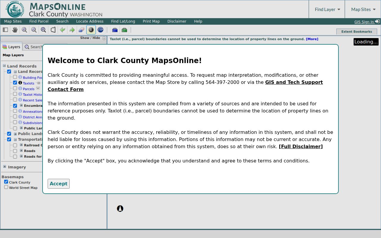
The map gives the street search a parcel base, but its lines are reference data rather than a land survey.
Vancouver Records Keyed by Street
Several Clark County and City of Vancouver systems accept an address or parcel. Each answers a different question. This coverage prevents an owner, filing party, or permit contact from being mislabeled as a resident.
| Address record | Keeper | What it establishes | Access |
|---|---|---|---|
| Parcel card | Clark County Assessor | PID, situs, mailing field, legal description, values and links | PIC by address or account; Joint Lobby for owner-name access |
| Parcel layers | Clark County GIS | Taxlots, roads, adjoining parcels, permits, annexation and ZIP context | MapsOnline Find Parcel, browse, and Identify |
| Recorded instruments | Clark County Auditor | Grantor, grantee, date, legal description and transfer trail | LandmarkWeb from 1961; office or archive earlier |
| Permit or code file | City or county development office | Address-keyed case, work type, dates, status and file clues | PIC links, map symbols, LMS/Tidemark, or request |
| Historical directory | CCHM, CCGS, FVRL, WSL | A name tied to an address or intersection in one issue | Reading room, film, transcription, catalog, or licensed database |
Voter records require special care. VoteWA is a personal account tool, not a public browse of everyone on a road. Requests for voter lists now go to the Washington Secretary of State and must meet statutory terms. A street directory cannot present that route as a quick household search.
Note: The county says ownership updates often appear weeks after a deed records, so save both dates when comparing a recent sale.
Browse Vancouver Parcels Along Streets
MapsOnline is the practical tool for moving from one lot to the next. Find Parcel accepts a parcel number, house number, or street address and supports partial matching. Select the result, zoom to the street segment, then turn on parcel, taxlot, road, address, subdivision, annexation, and ZIP layers as needed. Use Identify on a visible parcel to read its attributes. Copy each parcel ID and run it separately through PIC and the deed index.
This manual browse matters because no documented public radius or buffer control was found. It also avoids the false idea that street numbers must be consecutive. Corners, flag lots, multi-unit buildings, and parcels with frontage on another road can break a simple number sequence. At an intersection, inspect directional quadrant and hundred-block layers in the GIS Addressing service.
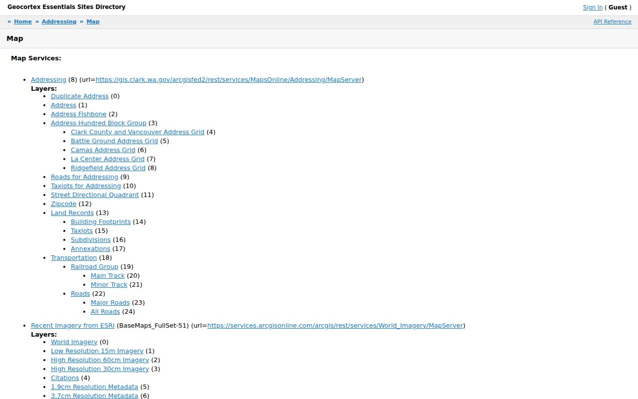
The service documents road, taxlot, subdivision, annexation, building, duplicate-address, hundred-block, and ZIP layers that can explain two similar address forms.
- Parcel
- A mapped unit of land with a county ID, not a list of the people inside.
- Situs address
- The street address assigned through the responsible jurisdiction's addressing process.
- Plat
- A recorded map dividing land into lots, blocks, tracts, streets, and other features.
- Criss-cross directory
- A directory arranged by address or street. No complete local reverse-directory year run was verified.
Which Vancouver Street Is It?
A Vancouver mailing label does not prove an address is inside the incorporated city. The name can describe a postal city, city planning area, Census ZIP Code Tabulation Area, or a parcel in Clark County. First use the City address boundary check. Then confirm PIC's jurisdiction field and inspect annexation lines.
This local quirk changes which office holds a permit or code file. A road may pass from city to county jurisdiction while its postal label stays familiar. East Vancouver's 1997 annexation nearly doubled the city's population, and Woodland Meadows entered city context after the July 2018 5th Plain Creek Station annexation. Such dates explain why the agency tied to one street can change over time.
Boundary check. Record the postal form, parcel jurisdiction, annexation context, and source date as four separate facts.
Follow Vancouver Streets Into Deeds
Once PIC supplies a parcel ID and legal description, move to Clark County LandmarkWeb. Search by parcel, instrument, grantor or grantee, legal description, book and page, record date, or excise number. A grantor gives an interest; a grantee receives one. Compare descriptions because one name can be tied to several properties.
The public index begins in 1961. Earlier deeds require a call, email, mail request, or visit to Auditor Recording, or a search through archives, FamilySearch, or a local library. Online images are convenience copies. Certified copies come from the Auditor. The counter is at the Public Service Center, 1300 Franklin Street, second floor. Call 564-397-2208 or email recording@clark.wa.gov.
Review the LandmarkWeb search interface before choosing fields.
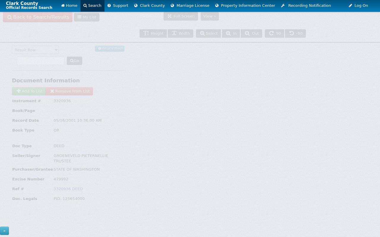
The interface bridges a parcel to dated instruments, but a recorded owner is not automatically an occupant.
Bridge Old Vancouver Street Forms
No official source confirmed one citywide street-renumbering or renaming year. Do not force an old address into a modern form. Search both “Clark” and the historical “Clarke” spelling, which persisted until 1925, plus “Vancouver District” and “Clark County.” Try directional forms, an intersection, subdivision, plat, block, and nearby business text.
The 1890 directory sample uses short forms such as cor, nr, bet, res, bds, and rms. Some entries omit a street number. Compare the entry to a period plat or the 1892 Vancouver Sanborn map, then bridge the block to the current address point and deed description. Its nine sheets show buildings and blocks, not all residents.
Streetcar history adds a local detail. Horse railway service ran from 1889 to 1895, electric service from 1908 to 1926, and tracks were paved over in 1926. Period maps may preserve a setting the current street does not show.
Note: When an old map and present parcel disagree, save the mismatch and seek the official plat or GIS explanation instead of guessing.
Request Vancouver Street Record Files
An online map or index may only point to the file. For city permits, plans, correspondence, or code records, make a focused request through the City public-records office. The city accepts online, mail, fax, in-person, and verbal requests. State the address, date range, department, record type, and known case number. For county material, use the department or Clark County GovQA.
Washington's five-business-day rule is a response point, not a promise that all records will arrive then. An agency may produce records, estimate time, seek clarification, redact protected parts, or cite an exemption. If the search concerns an older instrument, contact the Auditor before treating an absent web result as proof no deed exists.
Choose the custodian before sending the request. City Community Development holds city permit and land-use records. Clark County departments hold county-side files, while the Auditor keeps recorded instruments. Include a narrow block, street segment, or exact set of addresses when asking for street-level material. Add the dates and record type, such as issued permits or a named code case, rather than requesting every item about every person on the road. A clear scope helps staff locate the right system and explain any redaction or withheld field.
Inspection can be more useful than buying copies when the goal is to identify a file number or date. Ask whether the record can be reviewed first and how electronic delivery is handled. Keep the request, agency reply, production date, and any exemption note with the research log. If a map symbol points to a case but the detail is not online, give staff that case number and the mapped address. This route supplies the source document behind a street directory clue without assuming that the map preview contains the whole record.
Limits of Vancouver Street Directories
A Vancouver street directory cannot show every person in each home. A parcel field may name an owner, estate, trust, or group. The mailing address may be outside Vancouver. A deed proves a recorded interest, not daily presence. A permit identifies a case or applicant, while a dated directory captures only what its publisher included. One parcel also does not enumerate units in a large building.
VoteWA requires the voter's own name, birth date, and reCAPTCHA. It is not a public address browser. Full voter-data requests go through the Secretary of State, protected voters are withheld, and ballot choice is not disclosed. Utility, delivery, and driver address data are not ordinary street sources.
Lawful use. Use Vancouver address records for family research, parcel history, civic questions, or fraud prevention. Never use them to stalk, harass, intimidate, or harm anyone.
A careful by-street result states exactly what was found: parcel, jurisdiction, record party, instrument, permit, or dated entry. It includes the source date and limits. That restraint makes the street directory useful without turning an official clue into an unsupported resident claim.